Surface current monitoring analysis for Eastern Caribbean Sea and associated small island developing states
2014/08/02
OEA Technologies has initiated analysis of potential locations for CODAR HF radar systems within the small island developing states (SIDS) of the Eastern Caribbean Sea, from Trinidad and Tobago through to and including Antigua and Barbuda.
In the late 1990s, compact commercial HF radar systems emerged as a reliable means to monitor coastal surface currents. Today, there are hundreds of such installations world-wide. Although the Caribbean is ideally suited for this technology, Puerto Rico has the only installations to date. Specific applications include: disaster preparedness (oil spills, search and rescue, wave and tsunami warning), coastal engineering and management, vessel traffic management and marine science.
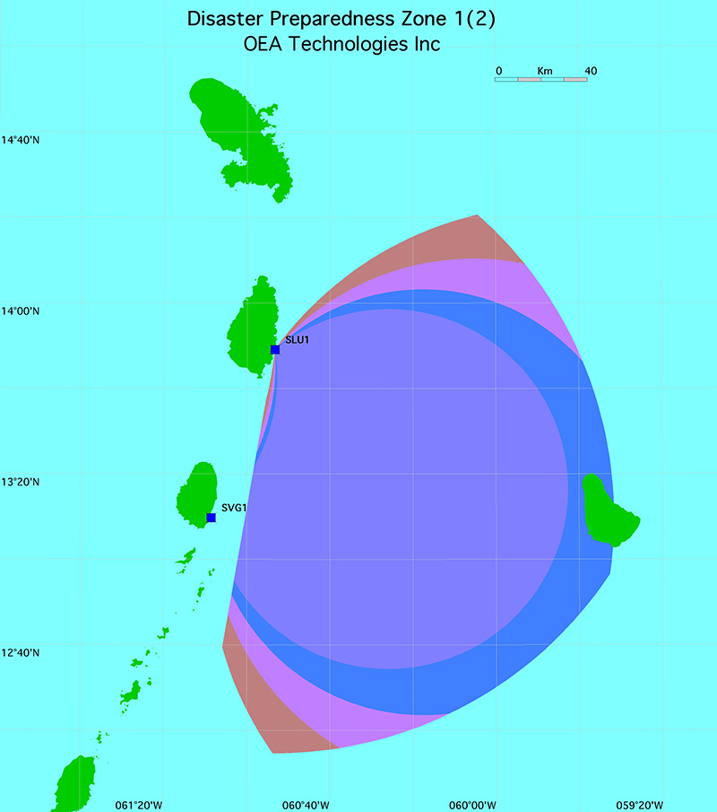
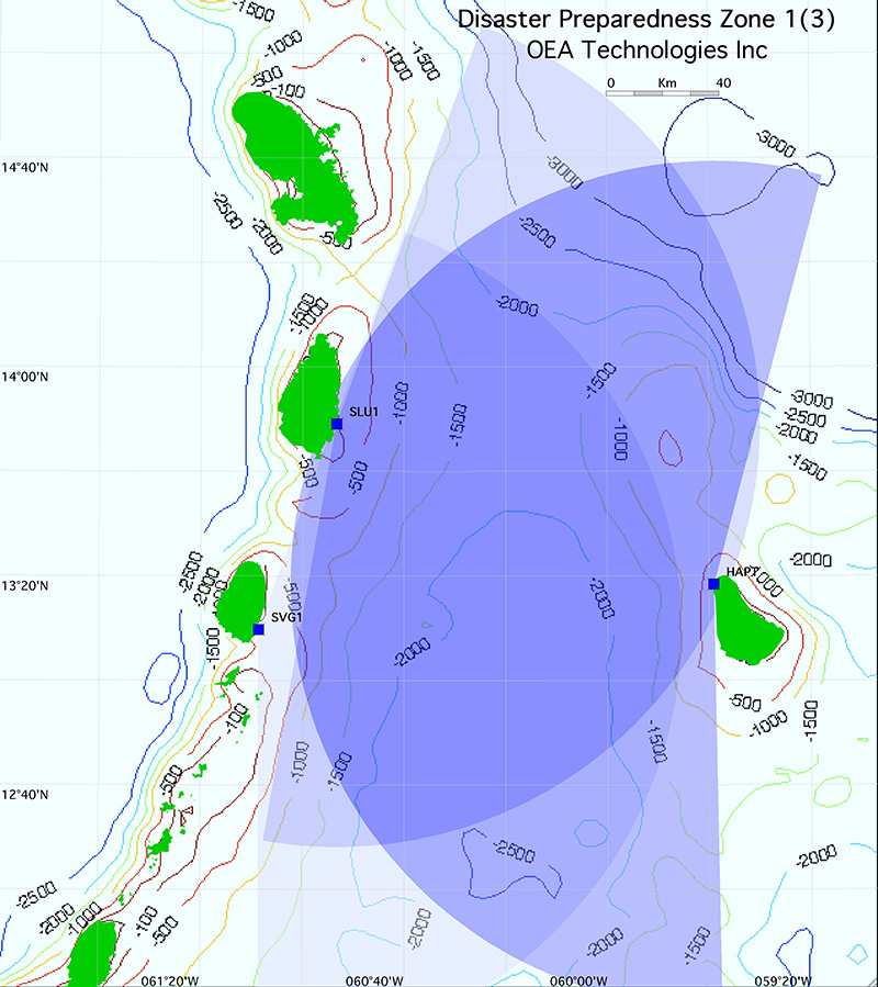
For Barbados and neighbouring islands, for example, long-range CODAR SeaSondes must be located on more than one island because there is insufficient coastline on any one island. This scenario is exemplified in Figure 1(a), which depicts theoretical surface current coverage obtained by two long-range CODAR SeaSondes, one on St. Lucia and the other on St. Vincent. Offshore range has been constrained to 175 km and the two SeaSondes are approximately seventy-five kilometers apart. Barbados is too far from St. Lucia and St. Vincent to be a primary long-range location. However, it is close enough to serve as an auxiliary location, as a means of increasing data density and coverage north and south. This scenario is depicted in Figure 1b. Primarily, this type of SeaSonde network is used for climate change research, oceanographic operations, wave monitoring, search and rescue, and disaster preparedness. This type of network may also benefit ship navigation.
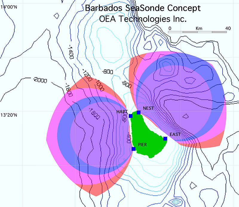
Standard SeaSondes, as opposed to long-range CODAR SeaSondes, are used for applications closer to shore, where greater spatial resolution is required and desired offshore range is not as great. Standard systems are used for coastal zone management, search and rescue, port services and marine research. They reach approximately 60 km offshore, with a spatial resolution of 0.5 to 3 km. Thus, for example, there is sufficient coastline on Barbados to install adjacent standard SeaSondes. An example theoretical surface current coverage map is provided in Figure 2.
Click on the photos below to enlarge.
 Figure 1a |
 Figure 1b |
 Figure 2 |
